| Status: | Active, open to new members |
| Leader: | |
| When: | Monthly on Tuesday mornings Monthly on 2nd Tuesday |
| Venue: | Scout Hut |
The Group normally meets at the Scout Hut on the second Tuesday of the month at 9.30 am (or tell the leader if going to drive direct to the walk starting point).
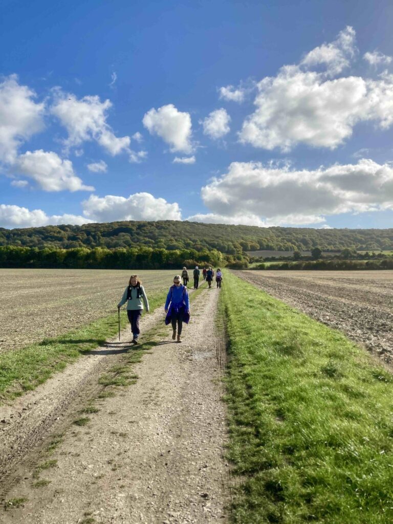
Walks are usually about 4.5 to 5.5 miles long. The dates for walks are shown below and more details will be added when the routes for the walks are announced.
Meet at the Southern Road Recreation Ground Car Park at 9:30 am and use whatever cars are available to go to the start of that morning’s walk. Please let the walk leader for the day know if you intend to go directly to the start of the walk. Any queries contact group/walk leader on the day between 8.30am and 9.00am.
Please note walkers take part at their own risk.
For more details of this group please contact Judi Taylor (Group Leader - Walks - Morning).
| 2026 Walks | Details | Leader(s) |
|---|---|---|
| 13 January | I'll be leading our first walk in 2026 which is going to be the delayed walk from December up to the Oxfordshire Golf Course. We'll meet at the junction of Morton Lane with Arnold Way at 10.00am and we'll have a coffee break when we get to the Golf Course, so those of you who might like a coffee indoors can do that. There's parking in Coombe Hill Crescent. | Judi Taylor |
| 10 February | As it has been raining so much the mud is still around, so I thought it would be nice to have a walk around the new areas set aside for nature behind the new housing developments in Thame and then ending up with a walk across Cuttlebrook. I still have to finalise the route but it will be about four and a half miles to five miles. Parking for this walk: There was little space along Elms Road but plenty in Windmill Road. We'll meet at the War Memorial at 10.00am or just after 10.00am in Elms Road near the junction with Windmill Road. Waterproof boots or shoes will be needed. | Judi Taylor |
| 10 March | Can join at Whiteleaf Hill car park at 10am.To get there from Longwick turn left at roundabout by filling station then first right to Monks Risborough. Right and then first left in village.Car park entrance on left at top of hill. Route will be along Ridgeway to Lower Cadsden and then take bridlepath and foot path up through woods before turning back along bridle path back towards Whiteleaf Cross. The walk is mostly woodland. | David Laver |
| 14 April | Meet at Southern Road car park at 9.30 a.m. -with object of starting walk at 10 a.m. Circular walk from Britwell Salome Red Lion OX49 5LG and return. We have permission to park in the Red Lion car park as they are shut on Tuesday. We should not take too many cars and be courteous how we park. This is a 5 mile walk, paths are quite varied with open views and woodland areas. One longish hill and corresponding downhill descent with some steps. Incorporating some sections of Ridgeway and Chiltern Way. | Bridget and Michael Weeks |
| 12 May | Our May walk is being lead by Charles. Here are the details he has sent about the walk. “The morning walk on 12 May will be Pulpit Hill and around Great Kimble. It is about 4 ½ miles, and comfortable to walk in under two hours. It does start with a steady climb up the Chilterns of about 20 minutes. We will make some stops but please check you can manage this steady climb. The good news is that it is nearly all flat or downhill after that. After a brief exploration of the old Pulpit Hill Fort, dating from the late Bronze Age/ early Iron Age, we’ll press on via Grangelands to walk through the fields at the back of Great Kimble. There are a couple of stiles near the end of the walk. Parking will be on the layby off the A4010 outside the house ‘Cymbeline’ just before the church at Great Kimble. Please park tidily as this is a favoured stop for dog walkers etc. Meet at the Scout Hut at 9.30 as usual or at the lay-by by about 9.50. Please let me (charles@boundyfamily.com) and Judi know in advance if you intend to come so that we can manage numbers and cars!. Thanks.” Look forward to seeing you then. This sounds a lovely walk with great views across the `Aylesbury Vale. | Charles Boundy |
| 9 June | Morning Walk Tuesday 9th June. 4 to 4 and a half miles from Christmas Common. Down through the woods, across some fields, along a track and up a steep hill to Northend. Then back via Launders Farm on a route with some minor ups and downs. Park at Christmas Common at the turn to Northend. GR 714933. Walk start 10.00. About 25 minutes from Thame. Anyone wanting/offering a lift please get in contact and we will co-ordinate. | Margaret and David Bishop |
| 7 July | ||
| 11 August | ||
| 8 September | ||
| 13 October | ||
| 10 November | ||
| 8 December |
| 2025 Walks | Details | Leader |
| 14 January | From the far end of the Waddesdon National Trust Carpark starting at 10.00am. Because of the mud everywhere I have chosen the route along the cycle path to the Aylesbury Vale railway station where there are toilets and refreshments and then back to the car park. It's a flat walk and is about 5 miles. | Judi Taylor |
| 11 February | Looking at Snowdrops-About 6 miles long and is a bit muddy in places. There is quite long hill and then a shorter one towards the end although the rest of the walk is flat. There are no stiles. Parking isn't very good so it would be helpful if people car shared. The meeting place is the bus stop at Cookley Green at 10.00am. | Kathy Lemaire |
| 11 March | Christmas Common. Meet in the car park in Thame at 9.30 to start the walk at 10 a.m. The walk is just under 5 miles. Turn left just before the Fox and Hounds pub (as a guide pub OX49 5HL) Park in the lay by on the right on the Northend road . There are a couple of hills (one fairly steep).It will be muddy in places so boots are essential. Woods, fields and views over the Chilterns. Will be returning past the pub so if anyone wishes they can go for a coffee. | Bridget and Michael Weeks |
| 8 April | After months feeling penned up this is a true Chilterns walk in a lesser-known area, tracing a round from Cadmore End via Fingest. There are some lovely woods which should just be coming into leaf and nice views. Away from the M40 it’s all very peaceful. When I did the walk in mid-March the ground was firm, mostly tracks with a solid pathway readily available on a few areas of muddy bridleway. The walk is designed to restore a spring to our strides! It’s only about 4 miles but does involve a steep downhill section through Hanger Wood and a steady uphill section towards the end. Otherwise its very generally undulating. Only one stile. Allow just over two hours (I am sure we could extend if anyone feels under-exercised!) No coffee stops unless the pub at Fingest happens to be open, which I doubt. Meet at the Guides Hut as usual at 9.30 or at the roadside parking in Church Road, Cadmore End HP14 3PE at 10 am, best accessed via Stokenchurch. | Charles Boundy |
| 13 May | - | - |
| 10 June | We'll be starting at the car park at Chinnor Railway Station, post code OX39 4ER although on the website it recommends using OX39 4BZ. We'll meet at the station at 10.00am, 9.30 at the Scout Hut if you would like a lift. Please let me know if you would like a lift so I can arrange it. We'll walk out towards the nature reserve and back along the Ridgeway. The walk will be between 4.5 and 5.00 miles and will be mostly on the flat. I'm hoping that we will see some different kinds of orchids compared with last year. | Judi Taylor |
| 8 July | Start at 10.00 from the Bell Inn at Chearsley (turn right to Chearsley in Long Crendon). There is some parking outside the pub, but we have found the best place to park is a left turn into Chilton Road, just as you come into the village. It is then just a short walk down to the Bell. The walk is 4.5 miles long and is a mix of lovely countryside and scenic villages. There is a village stores part way round for ice creams if its hot and the Bell Inn opens at 12.00. The usual arrangement for lifts from the Scout Hut apply. | Alison and Julian |
| 12 August | Shabbington circular walk 5 miles. Meet at the Scout Hut car park at 9.30 or go directly to the Old Fisherman pub at Shabbington where we will park the cars. HP18 9HJ. Start walk about 9.45 a.m. The walk is across fields and disused railway track, a little road walking and following the river Thame. There are three stiles one with a drop after, one short flight of steps a little difficult. Lovely views. Anybody who would like a drink or lunch it is available at the Old Fisherman by the river at the end of the walk. | Bridget and Michael Weeks |
| 9 September | This is a lovely walk of about 5.5 miles from Whiteleaf Hill car park (HP27 0RP), mixed woodland and open country, passing through the grounds of Chequers. Fairly strenuous. There is a long descent, steep in parts, at the start. This height is regained in a series of shorter ascents, none of which are as steep as the descent. There are no stiles. Refreshments from the 'Kitchen' at the half way mark at Buckmoorend Farm, where there is also a very good farm shop. There are also log stops in the woods shortly after. With a stop, probably best to allow three hours for the walk. To get to the car park, turn left at the Tesco roundabout in Princes Rsiborough. After about a mile, turn right into Peters lane shortly after the 30mph speed camera. The car park is at the top of the hill on the left. Meet there for a 10 am start, and at the Scout Hut at 9.30 for those who want lifts. | Julian |
| 14 October | 4.5 miles from Turville Heath to South End and round passing close to Turville and Turville Court returning to Turville Heath. A couple of sharpish hills, one down and one up. Good views and nothing too difficult. Park at Turville Heath. GR 745909 on the parking areas (sign for Pit Stop Cafe?) off the road/drive to Turville Grange. One route from Thame- go to Christmas Common and turn left to North End. Follow the road right and then left though North End and on to Turville Heath passing through an avenue of trees and turn left at the end just before the road junction. There are other routes! | Margaret & David Bishop |
| 11 November | We'll be meeting at St. Mary's Church in Thame at 10.00am and walking to Haddenham on a circular walk. It'll be about 5 miles and will be fairly flat. | Charles Boundy |
| 9 December | Christmas Lunch and get-together |
| 2024 Walks | Leader | |
| 9 January | A 5 mile walk around Waddesdon. The walk will be along roadways to avoid the mud. | Michael & Bridget Weeks |
| 13 February | 4-5 miles from Fingest, includes a hill or two. Park by the Church GR SU777912. Post code nearby pub RG96QD. Starts at 10.00. Route will depend on the weather. Anyone wanting/needing a lift contact us. | Margaret and David Bishop |
| 12 March | Cancelled. | |
| 9 April | A 5 mile walk from Nettlebed, through bluebell woods towards Nuffield Place. | Kathy |
| 14 May | A walk of about 4.5 miles through the Chilterns near Chequers. The walk is about 4.5 miles of fairly easy going, 2 gentle climbs, no stiles. | Rosemary |
| 11 June | A walk of about 4 miles through Cowlease Woods, then onto the Wormsley Estate. There's one long uphill which is not too steep and one short steep hill. | Judi Taylor |
| 9 July | Cancelled | |
| 13 August | Parking in South Waltonwell Road car park OX2 6ED Lower Wolvercote. Walk along the Thames and Oxford Canal. 5 miles. Flat, couple of stiles. Past Trout, ruined Abbey, Binsey Lane towards Oxford then onto the canal. Returning to Wolvercote. | Michael/Bridget Weeks |
| 10 September | Cancelled | |
| 8 October | 4 and 1/2 miles from Turville Heath towards Turville & round by Southend. One sharp descent, one gradual uphill with a sharpish bit at the end, the rest mostly flat. Only a couple of stiles now we think! Leaders Park at Turville Heath GR 745909. From Thame about 30minutes via Christmas Common & North End. Through an avenue of trees as you enter Turville Heath. Left after bus shelter and left again. | Margaret and David Bishop |
| 12 November | TBA | TBA |
| 10 December | Christmas get together |
| 2023 Walks | Leader | |
| 10 January | Cancelled | |
| 14 February | 5 mile circular walk from Towersey church. It is mostly flat but with a few styles. | Brian Fisher |
| 14 March | 5 mile circular walk from Piddington (Oxon). The walk includes a steep hill (with 360 degree views from the top of the hill), one stile and muddy patches through the farm. | Michael and Bridget Weeks |
| 11 April | 4.5 mile walk with a couple of hills taking in the villages of Fingest, Turville, Skirmett and touching on the edge of Little Frieth. | Margaret & David Bishop |
| 9 May | A 4.5 mile walk from Nettlebed to Russell Water Common via Warburg Nature Reserve. Two steep uphills, one downhill, one stile. Not likely to be muddy. | Anne and Brian Fisher |
| 13 June | A 4.5 mile walk from Cowlease Woods. There’s one long uphill and one short steep uphill. I hope we’ll see Fragrant Orchids and butterflies. | Judi Taylor |
| 11 July | A 4.5 mile walk from Wheatley to Cuddesdon and back. | Leigh Guyatt |
| 8 August | A 3.5 to 4 mile from Wheatley, with no stiles and two gentle hills. | Leigh Guyatt |
| 12 September | A 4.5 mile walk. Through Stonor park to South End, across to Turville Heath, along the ridge with good views and back down to the cars. | David & Margaret Bishop |
| 10 October | Cholesbury Common HP23 6ND. Beech woods, open fields, Grimms Ditch. 5 miles, 3 styles, few muddy patches. Usual meeting point. Please advise Mike/Bridget if going directly. N.B. Curently Butlers Cross/Wendover road closed. Can take v. narrow road via Hale Lane or turning for Wendover Woods. | Michael and Bridget Weeks |
| 14 November | A 5 mile walk from Bledlow. There will probably be some muddy patches. | Cate Andreopoulos |
| 12 December |